Click on an item on the map to view information about it

Chelan Butte
Chelan,
Washington
overview
LENGTH : 6 miles, round trip
ELEVATION GAIN : 2,000 ft.
TYPE : ski tour
HIGH POINT : 3,746 ft.
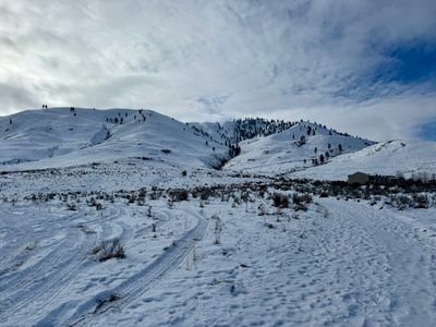
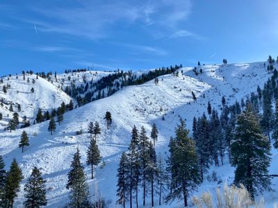
Chelan Butte rises a couple of thousand feet above the city of Chelan on southwestern edge of Lake Chelan. It is easy to understand why there was once a fire tower on the top, as the summit provides sweeping views of Lake Chelan, the Columbia River and the surrounding mountains. Chelan Butte is a popular hiking destination in the warmer months, and makes a great winter outing as well, both for snowshoeing and ski touring. There are a variety of aspects to ski on Chelan Butte, with the north facing slopes typically being the best bet.
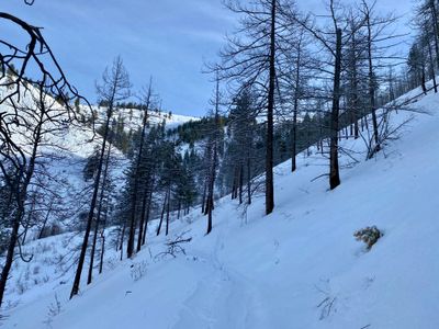
In the winter, one can start from the Chelan Butte trailhead and follow in the general direction of the summer trail, or break off from the summer trail and head up through what I call the northeast bowl. However if you find snow coverage lacking down towards the lake you can also start your tour over on Chelan Butte road. You can gain 700 feet of additional elevation in about a mile driving up the road, and park in a small turnaround near where the plowed road ends. From here, you can follow Chelan Butte road all the way up to the summit or opt to venture off and set your skin track on one of the ridges. The butte is very open, so there are endless possible routes up and down; use the map to see some possible options.
Placeholder in dev for ad
Directions
Parking
Trip Reports
February 8, 2025
DOWNLOAD GPXTOTAL MILEAGE : 6 miles, round trip
ELEVATION GAIN : 3,015 ft.
HIGH POINT : 3,746 ft.
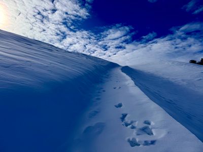
After the last couple of outings around Antilon Lake Sno-Park, it was time to get out in a different area and Chelan Butte was next up. After my son's basketball game at the Chelan Community Center on Saturday morning, I zipped over to the Chelan Butte Trailhead, ready to see what conditions I would find on Chelan Butte. I had walked my parent's dog over here earlier in the week, confirming there was barely enough snow on the ground to skin up and more importantly ski down from the Chelan Butte trailhead.
Chelan Butte
I had only skied Chelan Butte once before, two years ago, and during that excursion I started from higher up on Chelan Butte Road and just followed the road to the top. I followed the summer trail up until it crossed through the small ravine and decided to keep heading straight up through the valley. As it steepened a bit, I opted to start skinning up towards the ridge, where the summer trail crosses, and quickly gained some elevation and views of the lake. The skinning was a wee bit challenging in some of the steeper spots, but I never had to throw on my ski crampons.
First view of the lake
Nearing the ridge, I could see a skin track going up the bowl I planned to ski. If I had stayed the course in the valley instead of heading up to the ridge, I would have connected with the skin track. It looked like the folks who made the track followed the summer trail up until that point - I had noticed ski tracks while skinning up, but didn't see any sign of a skin track. Next time I will probably take the same approach, but continue up the valley and into the bowl. Seems better than going up to the ridge, and more direct than following the summer trail.
Skin track up to the ridge
I loosely started following the summer trail along the ridge, and made a mental note of the east bowl heading down towards the Columbia River - it had some short, but nice looking slopes dropping into it. Might be worth heading up to the summit and getting in a quick lap before skiing the northeast bowl.
Slopes dropping into east bowl
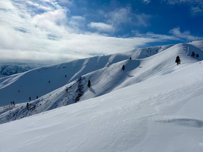
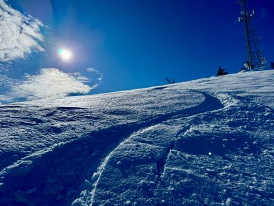
Higher up I saw some ski tracks heading into the northeast bowl which I planned to ski. I didn't see any evidence of the skin track heading up though, so not sure if these were a different set of tracks. I opted to head up to the summit of Chelan Butte, with the plan to ski one of the northern facing slopes going into the east bowl.
Following the summer trail up the ridge
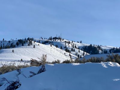
At the top of Chelan Butte, I headed past the cell towers and checked out the southern facing slopes. They did not look skiable, with lots of vegetation and rocks poking through on the top half, with snow snow by the bottom near the Columbia River. I skinned over a bit towards the east bowl, transitioned to ski mode and made my way down. There was some decent snow on the upper section, with some recycled powder on some aspects, and more breakable crust on others. Lower down it turned mostly crusty, and the slope angle flattened, so I stopped my descent and threw the skins on.
Turns off the top
I had planned on skinning up the south slope, heading in the direction of the northeast bowl I planned to ski next.But that idea went out the window as I looked at the coverage, or rather lack of it, on the southern facing slopes. I skinned up the gut back to the ridge and made my way over to the top of the bowl, ready for my next ski.
Ready for the next ski
The top part of the ski wasn't great, with crusty snow. However, the snow was a little better lower down, where the bowl was more protected. There were a decent number of ski tracks through the bowl, although they looked quite old. Curious if it was a big group or smaller number doing laps - I rarely see other tracks and haven't yet met anyone who ski tours locally.
Turns in the bowl
I was surprised to see a fairly large chunk of wind slab in the bowl. I skied over and could see the crown up above where the slope became steeper. The avalanche looked old, and it was hard to tell if it was skier triggered, but a good reminder that even on smaller mountains with not a lot of snow, avalanche danger still exists.
Avy debris in the bowl
The rest of the ski down was okay. There were some pockets of decent snow, but it was hard to find consistency. At the bottom of the bowl, I followed the summer trail back out. This was the hardest part of the tour! Skiing off the trail meant hitting an occasional rock, and staying on the trail meant skiing on a frozen bootpacked, but I managed to get down without injuring myself. It was fun to get out and check a new part of Chelan Butte. With this little coverage down low, it may be a better option to start up on Chelan Butte road...
January 19, 2023
DOWNLOAD GPXTOTAL MILEAGE : 5.8 miles, round trip
ELEVATION GAIN : 2,050 ft.
HIGH POINT : 3,746 ft.
It was a nice sunny afternoon and a perfect chance to explore a new area around Chelan. The previous summer, I hiked up Elephant Head but had yet to explore Chelan Butte proper. While driving into Chelan for errands over the previous month and a half, I eyed Chelan Butte for a ski, but wasn't confident the snow pack would hold up down by the lake and my excursions around the area had been focused on higher elevations.
I heard that Chelan Butte road was plowed part way up and there was a turnaround for parking. The extra elevation and ability to skin along the road made me confident snowpack wouldn't be an issue - at least when compared to what I had been skiing in the area. Sure enough, there was a decent amount of snow on the ground, and the road was well covered. I looked like some sort of snowcat or groomer had been up the trail, but maybe it was compact with tracks from numerous snowmobiles.
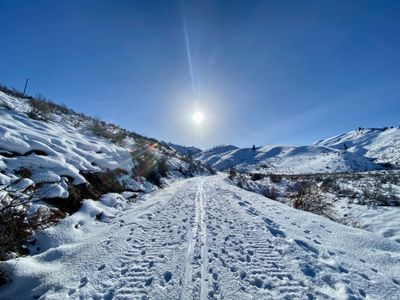
Looking up Chelan Butte road
The first mile or so of the road was straight, with a small amount of elevation gain, after which point, the road began a steady climb up the mountain. It was nice easy skinning, and at the first switchback I encountered, I decided to keep skinning up the road rather than taking a more direct approach up the drainage or nearby ridge. Off the road, the slopes were on the steeper side, at least for skinning, and given the firmness of the snow, I felt the road would be much easier and wouldn't take much additional time.
Chelan Butte
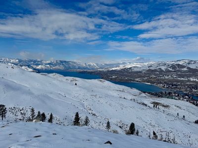
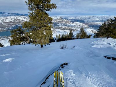
As I made my way up the road, I was treated to nice views of Lake Chelan, which only got better the higher I progressed. Once the road reached the ridge, I was able to catch glimpses of the Columbia River as well. I made a mental note to come back here and check out the ski down the Columbia River - The slope descends straight down to the river and could make for a scenic ski, although its southern facing and snow coverage may be an issue farther down the slope. Another ski to check out in the Chelan Valley, although I think I may have missed the window for this year.
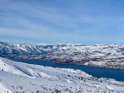
View of Lake Chelan
I caught a glimpse of something moving up on the ridge farther ahead, and I concluded it must have been a coyote. It was far away and I couldn't tell for sure, but it was either a dog or coyote. I didn't see any indication that someone was up here with a dog, and it seemed unlikely a dog would venture this far up on its own, so I'm going with a coyote.
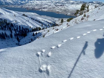
Coyote tracks overlooking Lake Chelan
I reached the final switchback and noticed the sun was getting close to dipping behind Chelan Butte. I would still have plenty of daylight available, but for some reason, I was really hoping to ski down with the sun at my back, rather than in the late afternoon shade. I picked up the pace, and was out of breath when I neared the top, and decided to transition for the ski down.
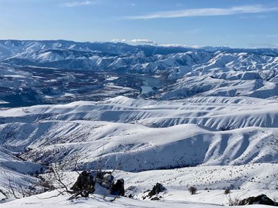
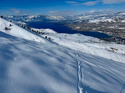
View of the Columbia River
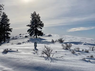
Nearing the top of Chelan Butte
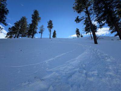
While skinning up, I had thought about skiing down a ridge near the road. But the ridge would have required a bit of a traverse to get to, and there was a nice open slope below me that was begging to be skied. I dropped in, and the skiing was great. The snow was firm, but edgeable and smooth and there was a nice consistent pitch. Eventually I made my way into some trees, and the snow became uneven, with evidence of tree bombs on the slope.
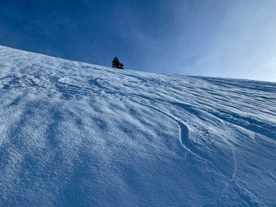
Turns near the top of Chelan Butte
While continuing to ski down into the drainage, I tried to work my way back over to the ridge. Eventually I decided to traverse over through a stand of trees, and skied down the ridge. The snow wasn't as smooth on this section, but it was still fairly open and a fun ski.
Traversing over to the ridge
Towards the bottom of the ridge, I had to figure out the best place to get back onto the road. The embankment directly above the road was either fairly steep or was covered in bushes. Eventually I found a spot that looked ok, and navigated through a hundred feet or so of bushes to get back on the road. The snow was still firm on the road, which made it a quick out to the car as I was able to ski almost the entire way back.
Looking up at Chelan Butte at the end
This is definitely a ski tour I will be doing again, as it's close by and can be done in a short amount of time. The skiing off the top was great and the views of the lake only help. I don't know that I chose the best line down, but I'm sure I will have more chances to explore the area and narrow in on the best descent.