
Ensign Peak
Salt Lake City,
Utah
Overview
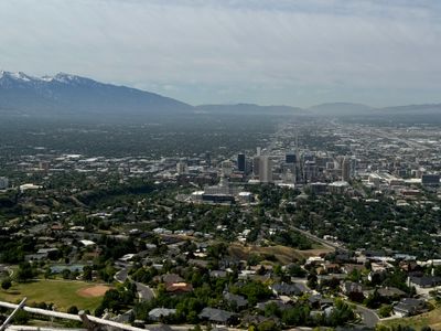
Ensign Peak is located in a northern residential neighborhood of Salt Lake City and with a moderate amount of elevation gain provides sweeping views of Salt Lake City including the capital building and the Great Salt Lake. While the mileage is small, it is a steady climb up and down. Interpretive signs on the summit describe how Bringham Young climbed the mountain to survey the area and plan how to settle the Salt Lake Valley.
Directions
Parking
Trip Reports
My wife and I had Juneteenth off from work while spending the week in Park City with my parents, and with my son in camp for the day, we decided to head down to Salt Lake City to grab lunch and explore. Wanting to get some exercise, we landed on Ensign Peak to kick off the day.
We were able to find parking on the street just past the trailhead, with lots of open spots along the street. On the hike we passed about five groups of people hiking up and down the trail - but it was a weekday and I wonder how busy the hike gets on the weekends?
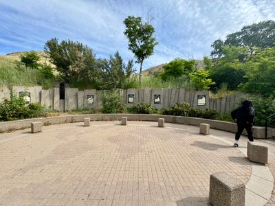
We took the stairs up and passed through a small circle plaza, before finding the trail to our right. It quickly started ascending and before long there was a trail off to the left that went to a view point, which we decided we would check out on our way back. For those not looking to do the full hike to the top, there is a much easier option that still provides nice views.
The wide dirt trail had a series of steps up the first section and at the first small flat section, my wife needed to take a break to catch her breath, as the elevation is much higher than what she is used to at home.
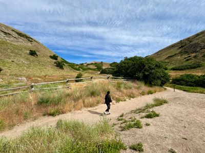
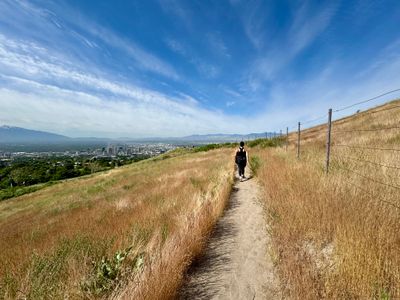
The trail wound around the side of Ensign Peak, passing through a grassy meadow with a split rail fence to one side. Reaching a small ridge that would lead us to the top, we were able to see the Great Salt Lake off in the distance.
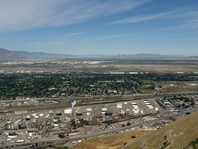
At the top we read the interpretive signs, detailing how Bringham Young and his group had come up to the top of Ensign Peak to survey the valley before settling the area. We enjoyed the nice views of the Capitol Building and Salt Lake City.
We retraced our steps back down the trail, and near the bottom took a right to head over to the viewpoint, which also had a nice view of Salt Lake City. We followed another trail for a bit, but it looked like it just wrapped around Ensign Peak and ended at a street, so we decided to head back to the car.
A quick hike with nice vistas of Salt Lake Valley, definitely worth doing if you are in the northern part of Salt Lake City and looking to get some exercise and views of the city.