Click on an item on the map to view information about it

Icicle Ridge
Leavenworth,
Washington
overview
LENGTH : 5.4 miles, roundtrip
ELEVATION GAIN : 1,800 ft.
TYPE : hike
HIGH POINT : 2,955 ft.
Icicle Ridge is located just outside of Leavenworth and this popular trail switchbacks up the side of a mountain through a mixture of forest and open slopes, depositing you at the top of the ridge where a couple of rounds of logs beckon to rest your weary legs after the 1,700 foot climb. The Icicle Ridge trail continues to the left up the ridge for another twenty plus miles. However, this hike turns right on the ridge and continues on a quarter mile spur trail with a little bit of up and down. This part along the ridge is through the forest and with shade and sweeping views of Tumwater Canyon and Highway 2 below, makes for an ideal break point during the summer months. The trail ends at an open area where you are rewarded with great views of Leavenworth. Retrace your steps back to the trailhead to complete this great hike, or head farther up the Icicle Ridge trail for a couple of miles for views of the Enchantments and Stuart Peak.
Placeholder in dev for ad
Directions
Parking
Trip Reports
August 17, 2024
DOWNLOAD GPXTOTAL MILEAGE : 5.5 miles, roundtrip
ELEVATION GAIN : 1,821 ft.
HIGH POINT : 2,955 ft.
I was home solo with my son for the weekend, and was looking to head up somewhere in the Leavenworth area for a hike. I brought up hiking the Tumwater Pipeline Trail to which he responded, "We are driving all the way to Leavenworth for a 2 mile hike?". I proceeded to tell him I was interested in hiking Icicle Ridge, but it would be the longest hike he has gone on (he is 9 years old) and wasn't sure he was up for it. After a little discussion about what treats we would bring for this long of a hike, he agreed to Icicle Ridge.
I drove right past the turnoff for the trailhead, catching a glimpse of what I thought might have been the sign. Sure enough, after turning around and heading back, it indeed was the road for the trailhead. There were a handful of cars as soon as we pulled in, and after finding a spot, we walked up a short distance to the trailhead and began our hike.
The trail started out with a very moderate incline, progressing up through the forest. It was a little before 10am and the temperatures were moderate, but it was still nice to start the hike in the shade. After a little while we exited the forest and hiked through some sun-exposed terrain. The remainder of the hike was similar, with a mixture of forest and open slopes, and even though the temps were in the mid eighties by the end of the hike, I never felt like I got too much sun.
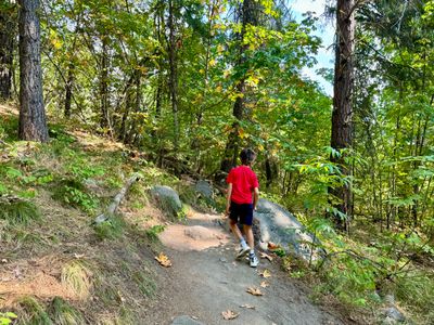
Start of the hike
Soon, we were hitting the switchbacks and the incline of the trail increased a bit; but it never felt particularly steep and with a moderate pace we progressed up the slope. We could see someone's swimming pool down below, and we joked about jumping in for a quick dip on the way out.
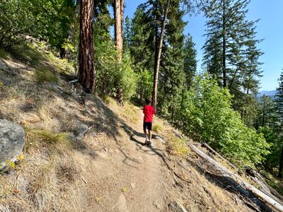
Switchbacks on the trail
About half way up I was startled by a small lizard that quickly scurried away from my descending foot. My son saw me jump back and was disappointed to learn it was a lizard and not a rattlesnake (he for some reason really wants to see a rattlesnake). We ended up seeing a number of lizards over the course of the hike.
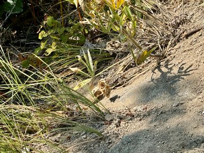
Lizard hiding in the vegetation
After a couple of breaks at each mile mark, we reached the saddle. We discussed stopping here for our lunch break, but decided we might as well hike to the end of the trail for lunch if there was shade, otherwise find a shady spot on the way back.
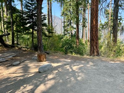
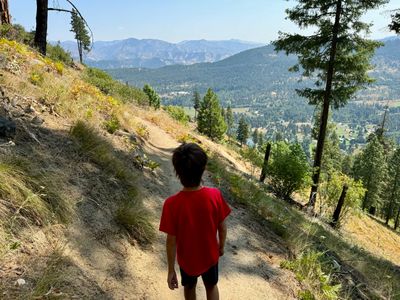
At the ridge where the trail splits
We had some nice views as we hiked along the ridge, with the cars on Highway 2 in Tumwater Canyon looking like ants. There were a couple groups of people resting on rocks along the way, enjoying the shade. My son was happy to be near the halfway point, and didn't complain as we descended slightly and then climbed the final bit towards the end.
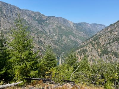
Tumwater Canyon
We were treated to nice views of Leavenworth at the end of the trail. I thought perhaps we would also be able to see the mountain coaster, but it was situated on a slope not visible from this vantage point. Given there was no shade on this section, we opted to head back towards the trail junction, and find a couple nice rocks to sit on in the shade.
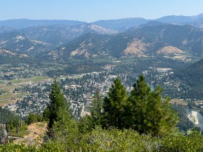
Leavenworth
During our lunch break we could see a couple of paragliders off in the distance. They eventually passed over the ridge. While enjoying our lunch, including some powerade and sour skittles gummies, we were eventually bombarded by honey bees, likely attracted to the sugar. It took awhile for them to congregate, but eventually there must have been at least 15 bees buzzing around. That was our signal to pack up, and start the hike back down to the car.
Heading Down
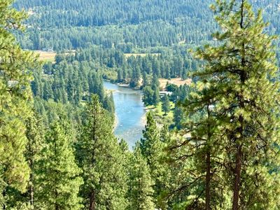
Closer to the bottom we could hear screams of delight from the tubers on the Wenatchee River. Eventually we came to a clearing and could see at least 15 tubes in the water on a short stretch of the river. On the drive out, there were a lot of cars parked on the shoulder of the road around the bridge.
Heading Down
At the bottom, my watch indicated we had come up a little short of the 6 mile mark. My son was insistent that we hit 6 miles, so we did a couple of laps around the parking lot until my watch registered 6 miles! It was a fun hike and I was proud of my son for making the trek without any complaints. There were a decent number of people on the trail, but not too busy. Would be a great hike in the spring with all the wildflowers.