
Mallory's Way
Chelan,
Washington
Overview
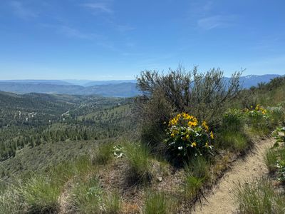
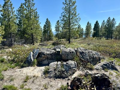
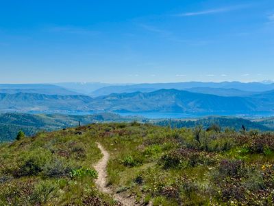
Mallory's Way is a moderately strenuous loop hike at Echo Ridge with views of Lake Chelan, the surrounding mountains and even the Waterville Plateau . From the North Junction Trailhead you will head north on the Outback trail, (you can also hike up / down Waterbar Heaven and hook back into Outback), after roughly a quarter mile Outback turns into a loop, either direction is fine for this hike. You will find Mallory's Trail on the west side of the mountain. Proceed up Mallory's trail until it splits, as the upper section of Mallory's Trail is also a loop. The best views of Lake Chelan are while hiking up the ridge prior to getting near the high point. Look for a summit register nestled in the rocks at the top.
Directions
Parking
Trip Reports
The only other time I had been up Mallory's Way was a number of years ago before moving to the area while on a family hike on Outback. I think my son was 5 years old, and I broke off from the family to quickly hike up Mallory's and then eventually caught back up with them. I had a little free time on a Sunday morning and decided to revisit.
I started up Outback and then broke off onto Waterbar Heaven for a change of pace. Once at the start of the Outback loop, I decided to head counter clockwise, to start off the hike with views of the lake. But I think either direction is fine, just a personal preference on my part.
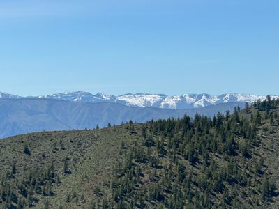
As I made my way around I could see Mount Stuart way off in the distance as well as Devil's Backbone. I wish I had paid more attention to the amount of snow on Devil's Backbone, because over a month later I ran into snow on the road on my way to hike around the area with my brother!
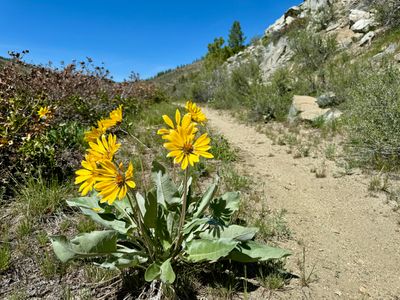
I was surprised by the lack of wildflowers. There were some arrowleaf balsamroots still in bloom, and a couple other varieties like phlox, but the Echo Ridge area seemed to be much drier than I was expecting. I guess we had a fairly dry spring, and it was noticeable up here.
Before I knew it, I was at the junction with Mallory's Way, and proceeded to hike up. The hike had been relatively flat until this point, but now progressed steadily up. I could make out some mountain bike tracks on the trail, and once I get a little more comfortable on my bike, I will have to try it out.

Once at the start of the loop, I headed counterclockwise again, although I really don't think it matters which way you go. Upon reaching the top, I surprisingly found a summit register and entered my name. My only other time up I didn't see it, but I can't say I was looking, as this isn't a prominent peak in the area.
After a quick water and food break, I continued on the Mallory's Way loop and wound around the other side of the mountain. As I headed back down towards Outback there were nice views of the lake.
I finished on Mallory's Way and then continued the loop on Outback and made it back to the car. I was surprised to see it was a little over 6 miles, although not a lot of elevation gain. It's a nice moderate hike at Echo Ridge and one I will surely do again.