
South Goff Ridge
Manson,
Washington
Overview
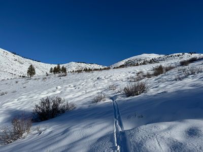
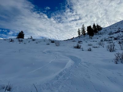
This small ridge extending southwest from Goff Peak offers some reasonably open sheltered northern slopes, allowing for a relatively quick tour from Antilon Lake Sno-Park. While the descent is relatively short, around 600 ft depending on where you stop, it's certainly a run you can lap multiple times, and these slopes can hold recycled powder during cold dry spells. The exit back to the car is straightforward, with some decent skiing lower down as you approach Grade Creek Road.
While you can follow the Johnson Creek Forest Service Road, I have found it more enjoyable to skin up Grade Creek Road and near Antilon Lake Site B (on the left hand side), veer off to the right and start ascending, contouring around the small mountain on your right. As the terrain flattens, hop on Antilon Creek Forest Service Road and follow that up the valley, and find a suitable place to lay a skin track up to the ridge. To exit, follow your skin track back out to Grade Creek Road.
Directions
Parking
Trip Reports
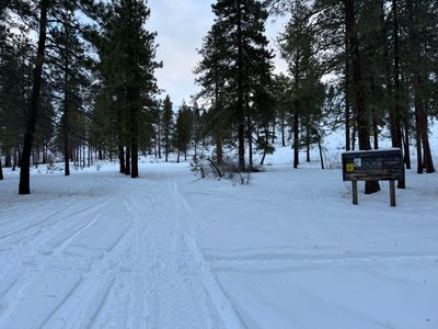
Recovered from the jetlag of our India trip, after some morning Friday meetings, I took a long lunch and headed back up to Antilon Lake, eager to complete the short tour I had bailed out on a week earlier. Skinning up Grade Creek Road, I followed my exit track as it left the road near Site B, and contoured around the mountain, overlapping with my existing skin track on the way up, but then veering off so as not to get pulled into the thicket of pine trees below Johnson Creek Forest Service Road.
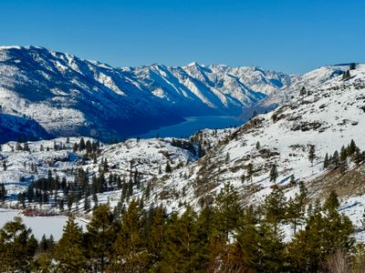
I followed my exit track up onto the road and proceeded along earlier my skin track, stopping along the way to snap photos of the lake. I was feeling much better this time around, and excited to get some halfway decent skiing in so close to home.
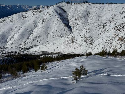
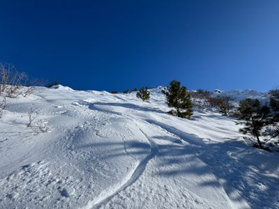
I went a little ways past where I had turned around last week, and then began yoyoing up the slope. It has a pretty good pitch to it, not particularly steep but enough to make it a fun ski. And the snow continued to look good, with a thick layer of faceted snow along this slope. Once near the ridge, there was some wind effect on certain aspects, but it was more scoured than a wind slab. Near the top I dug a pit and found distinct two ice layers below the recycled powder, but they looked pretty solid and I hadn't noticed any instability on the way up.
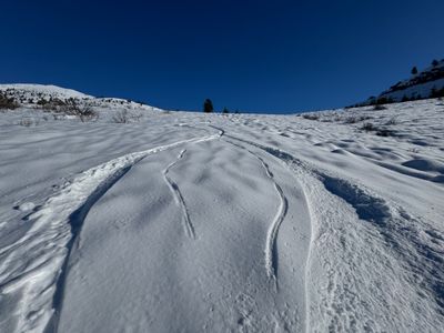
It was a bit windy at the top, so after a quick break to hydrate and munch on some food, I ripped the skins and started skiing down, taking my time until the snow became consistent. It certainly wasn't a deep powder day, but there was enough old powder that it skied well, and coverage was good enough on this northern aspect that I wasn't dodging bitterbush and sagebrush every other turn. There are a couple of open swathes on this slope, and while short, it's a pretty fun ski, at least for what's available in the area.
I stopped at the road, even though there was about a hundred feet more of skiing. I had to get back to work, and since I wasn't going to lap it, I didn't want to have to throw my skins back on. I was able to ski out down the road and then veer off to ski the lower slope back to Grade Creek, which just like last week actually skied pretty well. I'm surprised the snow held here, as it is lower elevation and a more western than northern aspect. The snow depth is lower here, and you have to be careful where you ski, but it wasn't too bad.
I skated out on Grade Creek Road, hopped in my car and was back to my house to finish up work in the afternoon. This ski tour isn't anything to write home about, but given it's less than 15 minutes from my house, and was holding pretty good snow weeks after the last storm, it's definitely one I will be doing again, especially when time is tight.
I had been chomping at the bit to get out around Antilon Lake, being less than 15 minutes from my house. An initial dump of snow in late November provided barely enough snow for very early season turns around Echo Ridge, but not quite enough for the lower elevations around Antilon Lake. Then a trip to India with the family meant I missed the next round of snow over Christmas and New Years. Finally back stateside, and wide awake at 3am in the morning due to the time change, I decided to head up to Antilon Lake once the darkness lifted.
There was no one at the Sno Park when I arrive around 8am, and I started making my way up Grade Creek, with an eye towards hitting a small ridge off of Goff Peak. I had skied the slope once before and had some decent conditions. But during that trip I had followed Johnson Creek Forest Service Road and then made my way up the southern slope towards the ridge. It had felt like a long slog following the forest service road, and I exited out a more direct way to Grade Creek and made a note to myself to try this approach sometime in the future.
After skinning up Grade Creek Road, I veered off to the right around Antilon Lake Site C and started making my way up the slope. I stayed pretty far to the lookers left, towards the small ravine. Eventually the slope got a little thick with small pine trees, but I was able to make my way up to the forest service road. In hindsight it would have been better to stay more in the middle avoiding the sidehilling and trees on the way to the road.
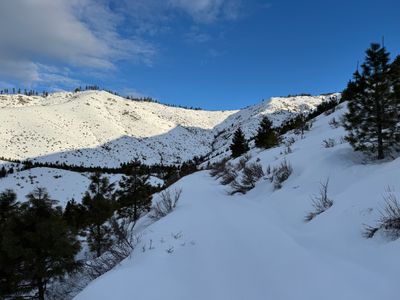
As I made my way up Antilon Creek Forest Service Road, I started to hit a wall - the jet lag seemed to really be taking a toll on me. I took a break when I got to a spot where I planned to ascend up the slope towards the ridge, enjoyed the views and a snack and water. After sitting for about 10 minutes, I decided to bail on the tour. While the snow actually looked good, I was exhausted and didn't have the energy to skin up. I ripped my skins and started skiing back down the road, veering off to follow my skin track down the slope. The turns were actually pretty good, with some recycled powder and enough coverage to not hit anything.
It was a bummer to not get much skiing in, but definitely the right call, especially when out by myself with spotty cell phone coverage. But given there was powder to be had close to my house, I knew I would be back as soon as I got over my jet lag.